 (Highway) you ask??? Well, I’ve never driven a road for over 2 1/2 hours in second gear at 25 miles per hour and called it a highway! We left Dawson City via the free ferry across the Yukon River. The first 5 miles or so were deceptively good and then the road deteriorated at the same time we hit the first uphill climb. Dave & I decided to drive both vehicles because we had heard tales about gravel chipping the heck out of tow vehicles. There are a few more pictures in the album titled 06-20 Top of the World at right.
The Top of the World (TOW) runs above the tree line and views of the mountain ranges are fantastic. We bounced along at a slow enough pace to enjoy the fantastic scenery, including seeing the top of a rainbow! Occasionally, we’d pass another vehicle, but we pretty much had the road to ourselves, so we could just stop in the middle of the road to snap pics. Once Dave stopped the RV for a fox and the fox rambled over to sniff his wheels, and then stood and posed for him.
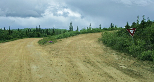
There was only one “major” intersection – a “Y” complete with a yield sign – with a road that was in worse shape than the TOW. When we passed through customs, the US agent had to check out the Scion. In fact, pretty much everywhere we go, people do a double take when they see the “box”. It’s been a great conversation starter; people will walk around it, look inside and have many questions about it. As we continued on our journey, we even got our first glimpse of Mt. McKinley – which was over 200 miles away! A wild ride, but we were thankful to arrive in Chicken, Alaska in the early afternoon.